
The South Island of New Zealand is bracing for a significant bout of severe weather this weekend, with MetService issuing a series of warnings for heavy rain, gale-force winds, thunderstorms, and even snow in alpine areas. Residents and travellers are urged to prepare for rapidly changing and potentially hazardous conditions as an active low-pressure system sweeps across the country.
Key Warnings and Areas Affected
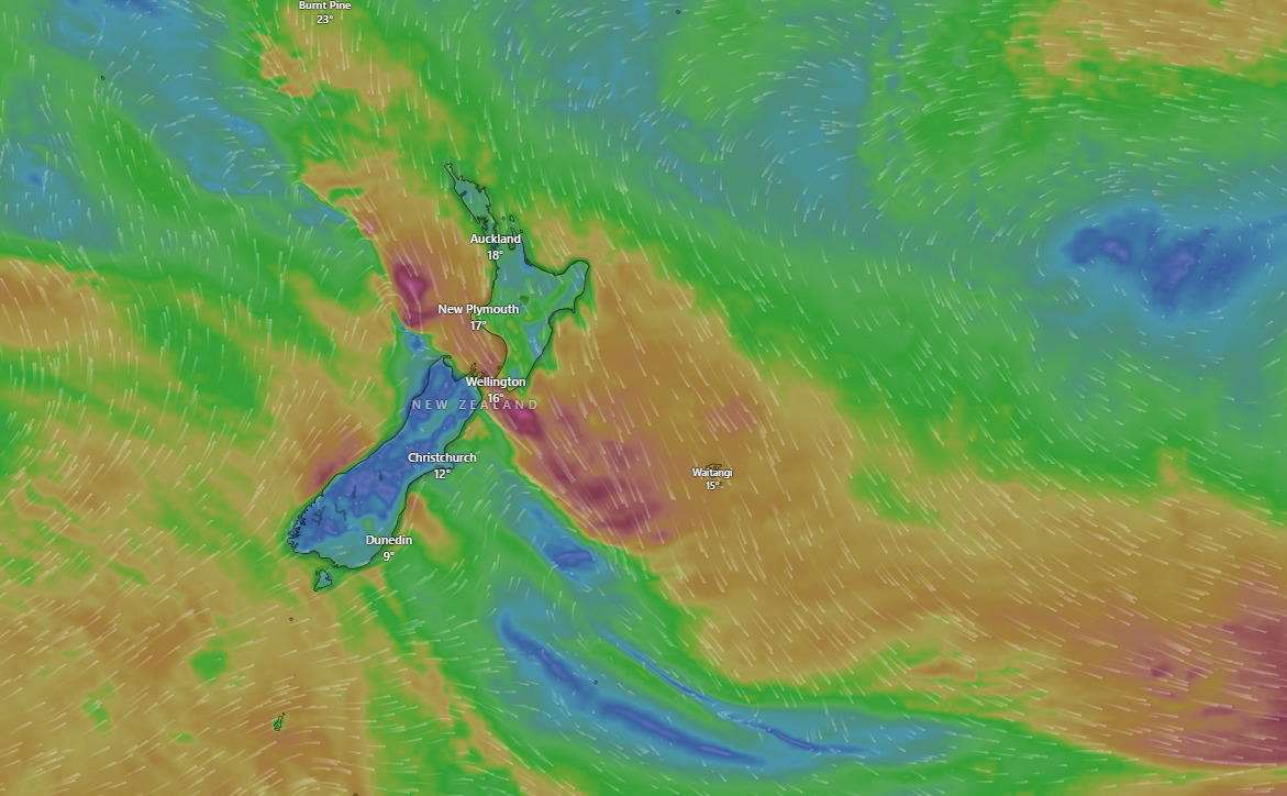
MetService has placed several regions of the South Island under heavy rain and strong wind watches, with the most severe conditions expected from Saturday into Sunday. The main areas at risk include:
- West Coast (Westland, Buller, Grey District Ranges, Fiordland north of Doubtful Sound): These regions are forecast to receive prolonged and intense rainfall, with totals potentially reaching up to 200–250 mm in the ranges. Localised flooding, slips, and rapidly rising rivers are possible.
- Canterbury and Otago Headwaters: The headwaters of the Canterbury and Otago lakes and rivers are also under a heavy rain watch, with significant runoff expected in alpine catchments.
- Canterbury High Country and Marlborough: Strong northwest winds are forecast, with gusts up to 120 km/h in exposed places. These winds may damage trees, powerlines, and unsecured structures, and create hazardous driving conditions, especially for high-sided vehicles and motorcycles.
- Snowfall: Temperatures are expected to drop sharply, with snow possible down to 800 metres around Tekapo and the Mackenzie Country. Alpine passes could become treacherous, and motorists are advised to check conditions before travelling.
Weather System Overview
The severe weather is being driven by a deepening low-pressure system moving east across the South Island, drawing in moist, unstable air from the Tasman Sea. As the system tracks northwards, it will bring a band of heavy rain to the western regions and strong, gusty northwesterlies to eastern and central areas. Thunderstorms are possible, particularly in the west, adding to the risk of localised downpours and lightning.
The east of the South Island may see some brief spells of clearer weather due to a lingering high-pressure system, but this will be short-lived as the front moves through.
Timeline and What to Expect
- Saturday: Heavy rain begins on the West Coast and Fiordland, spreading north and east through the day. Strong northwesterly winds develop in the Canterbury High Country and Marlborough, peaking in the afternoon and evening.
- Sunday: The rain and wind move up the country, with the North Island expected to see deteriorating conditions later in the day. In the South Island, the worst of the weather will gradually ease, but rivers may remain high and slips are possible in saturated areas.
- Snow: As colder air arrives, snow is likely to fall to lower elevations in the southern Alps and Mackenzie Country, potentially affecting travel on alpine roads.
Impacts and Safety Advice
- Flooding and Slips: With the potential for very heavy rain, especially in the mountains and ranges, local flooding and slips are a real risk. Rivers and streams may rise rapidly, and low-lying areas could be inundated.
- Wind Damage: Gusts up to 120 km/h can bring down trees and powerlines, damage roofs and sheds, and make driving dangerous. Residents should secure outdoor furniture and trampolines, and avoid parking under large trees.
- Travel Disruption: Alpine passes and high-country roads could be affected by snow, strong winds, and surface flooding. Motorists are advised to delay non-essential travel, check road conditions, and carry chains if heading into alpine areas.
- Power Outages: Strong winds may cause power outages, especially in rural and exposed communities. Keep torches, batteries, and emergency supplies handy.
What MetService and Authorities Are Saying
MetService meteorologists emphasise that this is a dynamic and potentially dangerous weather event, urging people to keep up to date with the latest warnings and forecasts. The agency highlights that the combination of heavy rain, strong winds, and possible thunderstorms increases the risk of sudden changes in conditions.
Authorities recommend rethinking any weekend outdoor plans in the affected regions and making the most of any settled weather before the system arrives. Farmers and those in flood-prone areas should take precautions to protect stock, property, and equipment.
Recent Context: A Wet and Wild May
This warning comes just a week after parts of Canterbury and Wellington were battered by record rainfall and damaging winds, causing flooding, power outages, and travel chaos. While the hardest-hit areas from last week’s storm may be spared the worst this time, the West Coast and alpine regions are firmly in the firing line.
What to Do
- Stay informed: Monitor MetService updates and local Civil Defence advice.
- Prepare for power cuts: Charge devices, stock up on essentials, and have a plan for heating and lighting.
- Avoid unnecessary travel: Especially in high-risk areas or during peak wind and rain periods.
- Check on neighbours: Particularly elderly or vulnerable people who may need assistance.
Summary
A severe weather system is set to impact the South Island this weekend, bringing heavy rain, gale-force winds, thunderstorms, and snow to alpine areas. MetService has issued multiple warnings, and residents are urged to prepare for flooding, wind damage, and travel disruption. Stay alert, follow official advice, and take precautions to keep yourself and your whānau safe as this powerful system moves through.