


 Theodora Chapman
 New Zealand is experiencing a sharp and sudden drop in temperatures this week, with forecasters warning of snow to low levels, thundery downpours, and a marked transition to wintry conditions. After a string of record-warm winters and a notably mild start to autumn, this abrupt change is catching many by surprise. Here’s what’s driving the cold snap, what regions are most affected, and what to expect in the days ahead.
What’s Happening: A Dramatic Temperature Plunge
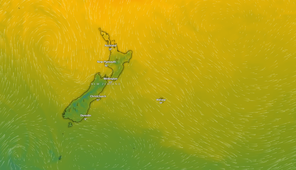
Meteorologists report that a powerful cold front is sweeping up from the Southern Ocean, bringing a rapid fall in temperatures across the South Island and into the lower North Island. Inland areas and regions exposed to southerly winds are seeing the most pronounced effects, with some places experiencing temperature drops of 8–10°C within a matter of hours. Snow is forecast to reach low elevations, and heavy rain and thunderstorms are expected in several regions.
Weather Data: Recent Observations
- Kaikōura: According to MetService and timeanddate.com, Kaikōura’s temperature yesterday ranged from a high of 18°C (64°F) at midday to a low of 12°C (53°F) in the early morning, with a noticeable cooling trend in the evening and overnight. Over the past week, maximums have dropped from the low 20s to the mid-teens, signalling the arrival of colder air masses.
- National Trends: WeatherWatch and NIWA confirm that the temperature drop is widespread, with the South Island leading the transition and cooler air expected to reach the North Island by the weekend. Snow and wintry showers are forecast for Canterbury, Otago, and Southland, while Wellington and Hawke’s Bay will also feel the chill as the cold air moves northwards.
What’s Causing the Sudden Cold Snap?
The abrupt change is driven by a combination of meteorological factors:
- Southern Ocean Cold Front: A strong, fast-moving cold front is pushing northwards, replacing the mild, moist air that has dominated much of autumn with much colder, drier air from Antarctica.
- Change in Wind Patterns: A shift from northerly to southerly winds is funnelling cold air directly onto the country, accelerating the temperature drop.
- Atmospheric Instability: The clash between warm and cold air masses is fuelling thunderstorms and, in some places, hail and sleet.
This pattern is typical of early winter in New Zealand, but the speed and intensity of this event are notable after a prolonged period of above-average temperatures.
Impacts Across the Country
South Island
- Canterbury and Otago: Residents are bracing for snow down to low levels, icy roads, and the first real taste of winter. Farmers are being warned to prepare stock for sudden cold and possible snow cover.
- Kaikōura and Marlborough: Temperatures have dropped rapidly, with overnight lows in the single digits and the risk of frost increasing.
- Southland and Fiordland: The cold front has already passed through, bringing strong winds, rain, and a sharp drop in temperature.
North Island
- Wellington: The capital is set for a blustery, cold weekend with southerly gales and temperatures several degrees below average.
- Central Plateau: Snow is forecast for the Desert Road and higher elevations, potentially disrupting travel.
- Auckland and Northland: While the temperature drop will be less severe, residents will notice cooler mornings and brisk southerlies.
Why Is This So Noticeable?
New Zealand has just come through three consecutive record-warm winters, with 2022 being the warmest on record. This has set expectations for milder conditions and reduced the country’s collective “cold tolerance.” The sudden return of classic wintry weather feels more dramatic as a result.
What Should You Do?
- Dress Warmly: Layer up, especially in the mornings and evenings.
- Prepare for Frost: Gardeners and farmers should take precautions to protect sensitive plants and livestock.
- Travel Safely: Snow and ice may affect roads, especially in the South Island and central North Island. Check MetService and NZTA updates before travelling.
- Check Heating: Make sure your home heating is ready for a sustained cold spell.
How Long Will It Last?
Forecasters expect the cold snap to persist into the weekend, with a gradual easing early next week. However, more cold fronts are possible as winter progresses, so this may be the first of several wintry outbreaks.
Climate Context
While sudden cold snaps are part of New Zealand’s natural climate variability, the backdrop of long-term warming means such events can feel more extreme. Meteorologists note that the current cold front is not unusual for June, but stands out against recent years’ mild conditions and the public’s expectation of warmer winters.
Summary
A powerful cold front is bringing a sudden and sharp drop in temperatures across New Zealand, with snow, frosts, and wintry showers expected in many regions. After years of record warmth, this return to classic winter weather is a reminder of the country’s climate variability. Residents are advised to prepare for cold, take care on the roads, and keep an eye on forecasts as the cold snap continues.